Geography Is the Chessboard of History: Bonus Content Geography Is the Chessboard of History: Bonus Content
Some content could not be imported from the original document. View content ↗
Spain, France, Germany, and a few more ways Geography has impacted History
2021年5月27日
∙ Paid
Welcome back to this week’s premium newsletter!
A few weeks ago you read “Geography Is the Chessboard of History”. How does it feel to look at maps this way? Isn’t it like a superpower? You can look at a map of any given country and start understanding its History, Economy and Politics.
We did it for Switzerland last week. This week, I wanted to go deep into a few more examples so you can see how consistent the trend is. So here are Spain, France, and Germany. Along the way, we’re going to learn a few more factors that influence history, teasing up the next installments in the series. The next one will then cover the US and the world. If you want me to analyze other countries, write them in the comments and tell me if there’s anything specific you’re interested in. Did somebody forward you this email? Make sure you receive the next installments and subscribe!
Spain’s Curse Was Its Luck
Look at this map and try to figure out: What kind of country or countries can emerge from here? I’ll ask you a specific question below.
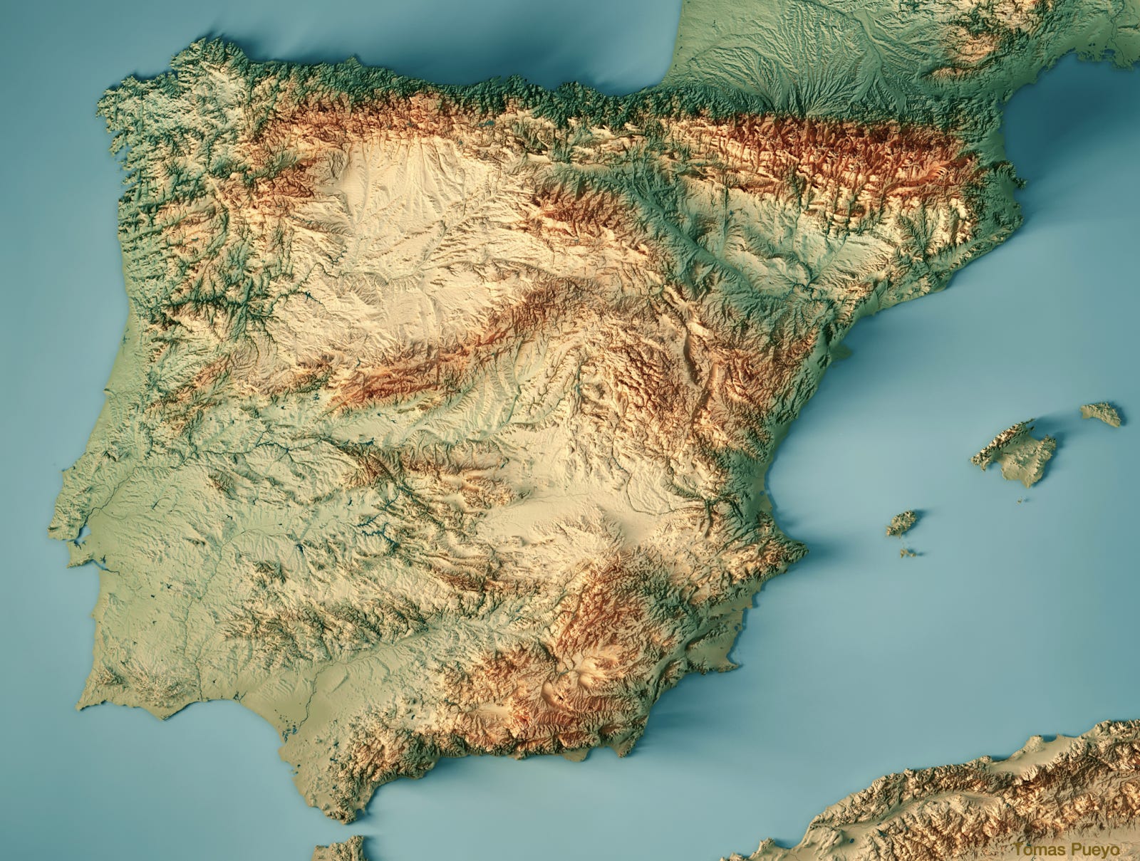
Was this country meant to be centralized around a strong patriotic feeling, or rather federalized, made up of many different regional sentiments?
Too many mountains everywhere, slashing the peninsula left and right, to allow for a strong central government.
This helps understand the Reconquista, when Christians took back the peninsula from Muslims. At the height of their might, Muslims ruled all but the northern mountains, which were too hard to pass and control.
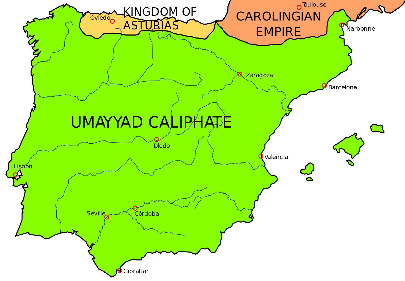
Northern kingdoms formed in the mountains, protected from the Muslims. But since they were created over mountains, they were also hard to unite, so several Christian kingdoms emerged. Since they had a common enemy, they didn’t fight each other too much, concentrating against the Muslims in the south. Hence, each kingdom stretched itself south during the Reconquista.
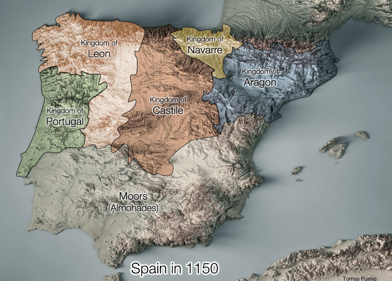
Eventually, by 1492, the biggest kingdoms had united (Leon, Castilla and Aragon [1] ). But it took 700 years to both conquer the peninsula and unite. And without a common enemy, they might never have united.
Centuries later, Spain was an international superpower. How is this possible given this type of geography? The question shouldn’t be why it lost its empire, but rather how on earth it was able to become one of the biggest empires in world history and remain so for centuries.
The answer is luck—some geographic, some historic. The kings that unified Spain (“Reyes Católicos”) in 1492 also made the best-paying bet in world history [2] by financing the Columbus voyage that the Portuguese, Venetians, and Genoans had ditched [3] . That gave Spain first dibs on America, and decades—or centuries—of early advantage in colonizing it and extracting its resources. That’s the historical “luck”. The geographic luck is that it is one of the closest European areas to America. Every single Western European country with easy access to the Atlantic was able to build colonies in America (Portugal, Spain, France, Britain, Netherlands), and no other country could, because they would have had to pass these hostile countries on their way.
Going back to Spain’s Geography, the mountains are not just problematic for trade, communication, and unity. They are terrible for the weather.
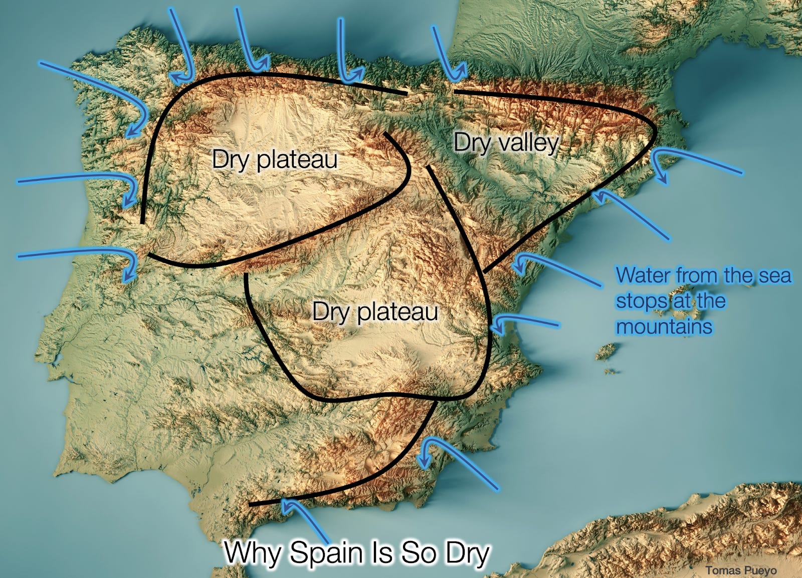
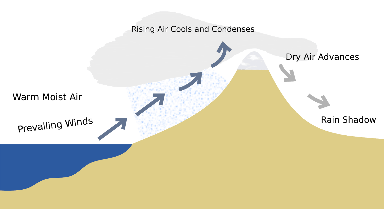
Because nearly all the Spanish coast is surrounded by mountains, when clouds arrive, they drop all the water before they make it to the interior. This is called Rain Shadow: As wind full of moisture arrives on land, it goes up, pushed by the mountains. There, the air is cooler, so the water condenses, and it rains. The dry winds proceed to pass the mountains, and once on the other side, there’s no water left.
You could then go one step further and ask yourself: But why does the Iberian peninsula have so many mountains everywhere?
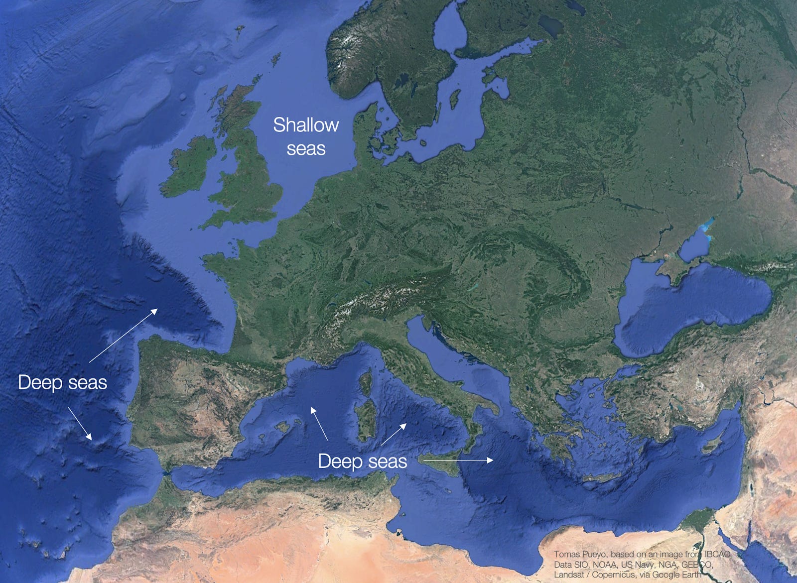
The sea around Spain and Portugal is very very deep. That’s why waves are so good for surfing on their Atlantic side, and much better than in France, Ireland, or the UK.
Unfortunately, it also means that when the continental shelf goes up from the deep sea, it goes up vertically, passes the sea level, and continues going up, forming mountains. This is true for all Southern Europe.
Compare that with Northern Europe, which has a very shallow sea—the extension of the flatlands of the north. Spain could never gain land on the sea the way the Netherlands do.
The effect that mountains have on national (dis)unity is extremely common. So much so, that one area has given it a name: Balkanization.
Balkanization
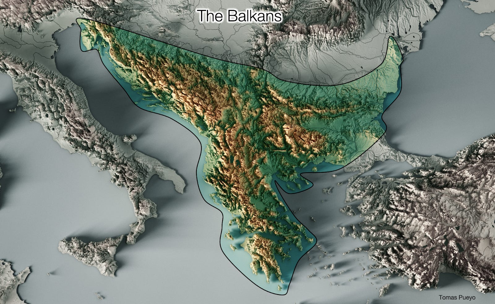
With so many mountains everywhere, it’s very hard to unite anything here. That’s why a region smaller than France includes Slovenia, Croatia, Serbia, Bosnia Herzegovina, Montenegro, Kosovo, Albania, North Macedonia, continental Greece, and part of Bulgaria. For now.
Every valley is so secluded from the other that it’s difficult to build a sentiment of unity.
France Is One Country Controlling Another
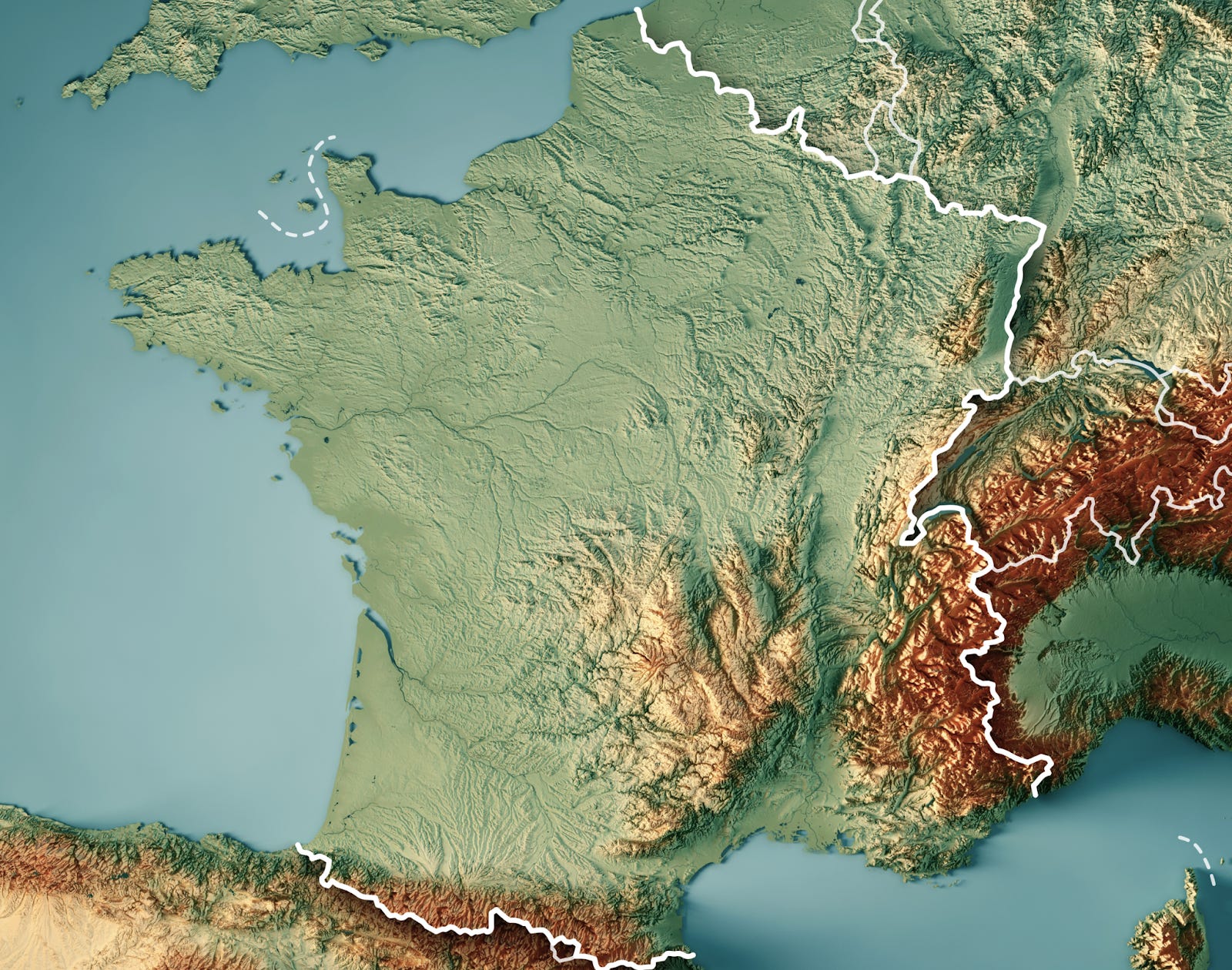
France is interesting. The north and west parts are very flat. As you can guess, they are the richer, more populated areas.
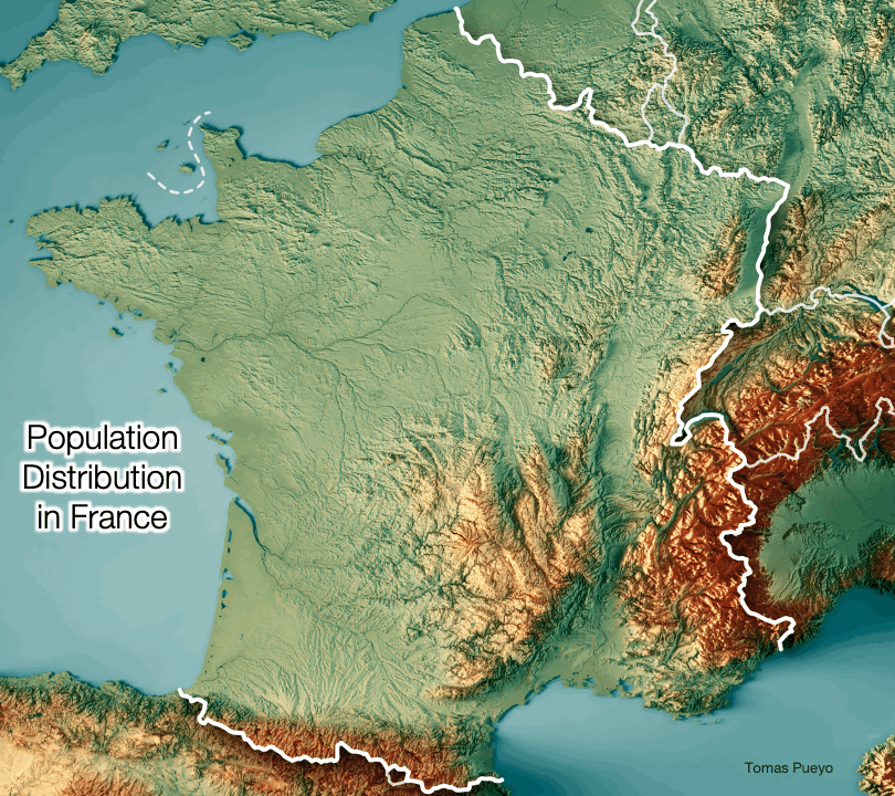
The north is flat but not homogeneously populated. Why? Maybe this will clarify it:
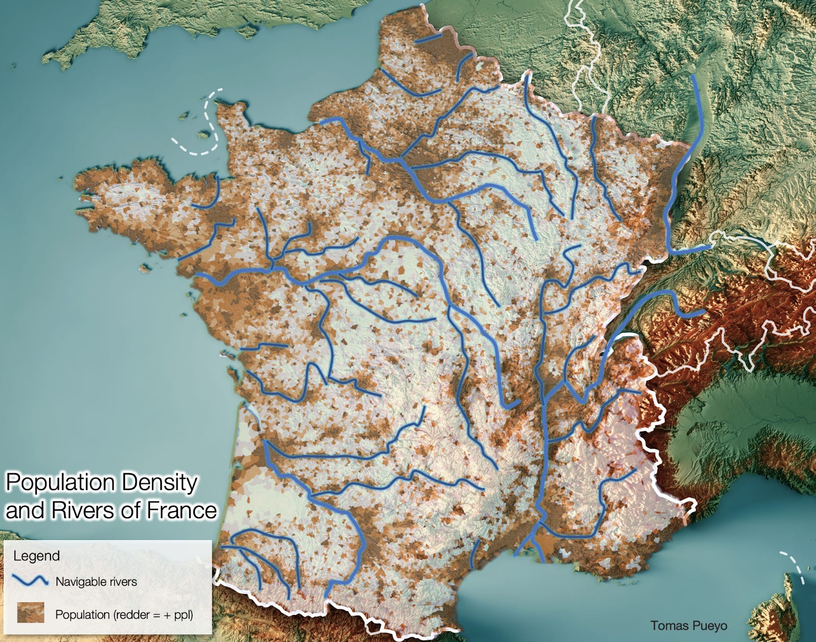
Wherever there are rivers, there are people. The more rivers and the more navigable, the more people.
All of this might be why Paris is where it is: The perfect capital would be on a navigable river, but not in the middle of the country. Rather, it would be in the middle of the rich northern plains, even if it’s very much in the north of the country.
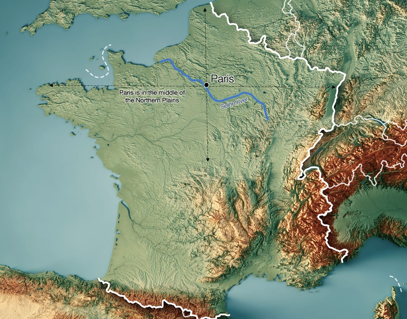
The comparative wealth and power concentrated in the Northern Plains—and hence, Paris, can be seen in many aspects of the country’s History.
For example, completely disconnected events such as French dialects and the Nazi invasion had something in common:
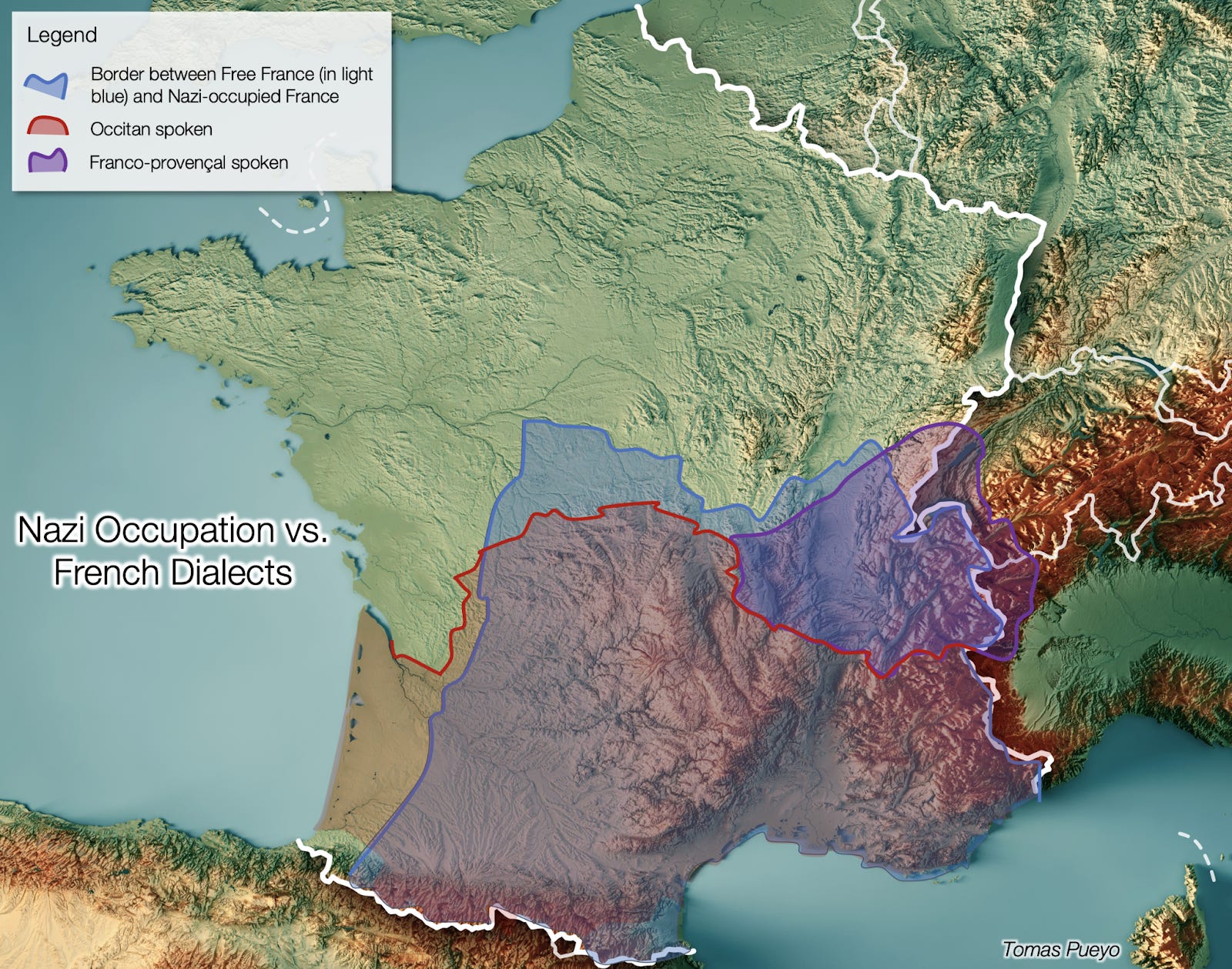
What’s known today as French is the variant that was spoken in the Northern Plains, the “Langue d’Oil”. The south had dialects in the Middle Ages that coalesced around a couple, Occitan in the south and Franco-Provençal in the east. These emerged because of the difficulty in transport and communication in the mountainous south.
This is also one of the main reasons why the Nazis split France in half between 1941 and 1942. They had captured the north, which was much more useful, and were overextended. If they had continued south, they would have had to lengthen their supply lines while conquering a harder terrain that was less valuable. They decided to stop, place a puppet government in the south, and give it some autonomy until they took it over completely a couple of years later.
Two events seemingly disparate, separated by centuries, turned out to be similar due to their influence by the same factor: Geography.
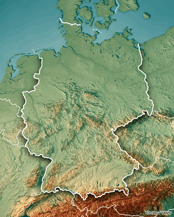
Where are Germans?
By now you should be able to see a map and tell a lot of things. Let’s try a final one with Germany. Try to guess where people are living:

Ok, here it is:
Takeaways
You can play this game yourself: superimpose topographic maps with wealth or population maps, and every single time you’ll see the same pattern.
As we saw last time and reinforced in this newsletter, rivers, mountains, seas and plains are huge contributors to History. But today I started hinting at some other geographic factors that drive History: I mentioned the continental shelf of Western Europe, or how winds interact with mountains to create dry areas.
In the next installments of this series, we will travel to the US before expanding our analysis to the dynamics that happen at a global scale. There, we will discover more of these geographic factors that determine History, before we move into the next stage: the role of technology in all of this.
How interesting was this newsletter? Do you have suggestions? Insights? Leave a comment! 👇
If you like looking at countries this way and you want me to do others, let me know. China, India, Iran, Brazil, Russia, Japan… there are so many with interesting geo-histories to decipher!
Next week, I’ll dive into a new topic: remote work. It’s a crucial topic: it’s intimately connected with COVID, but also with how technology transcends geography, with automation, with inequality, and so many other topics relevant to this newsletter.
This newsletter is only for premium subscribers of Uncharted Territories. Did somebody forward you this email? Feel free to subscribe (either to the regular or premium newsletter!)
Although Aragon was initially based inland, it had become pretty much a thalassocracy, like Rome or Greece had been, and Venice or Genoa were at that time. It didn’t just bring to the Spanish crown the eastern part of the Iberian peninsula, but also the Balearic islands, Sardinia, Sicily, and southern Italy (the Kingdom of Naples).
I always thought: “Wow, what a coincidence that such momentous events happened the same year!” But researching this I realized it wasn’t a coincidence at all. Columbus followed the kings until they were ready for him, which only happened after they had conquered the Iberian peninsula, which happened in January 1492. Columbus would be ready to sail soon after, and reached America in October of that year.
Portugal had less of an incentive to fund Columbus because it had just found a way to India through Africa’s southern Cape of Good Hope. Financing a highly risky, competitive endeavor made no sense. Venetians and Genoans had strong commercial interest in the land path to India and China, since they controlled much of the trade in the Mediterranean. Spain, in contrast, was a new state with little to lose and a desperate need for an alternative to the current trade paths.